INFRASTRUCTURE
TRANSPORTATION INFRASTRUCTURE.
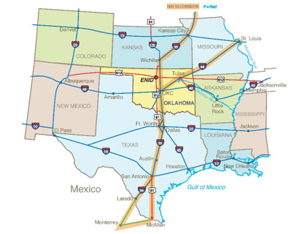
Enid offers unparalleled transportation opportunities to get you or your product anywhere in the world with ease. Centrally located on the United States, our integrated transportation system of highways, railroads, airports and inland ports ensures that you can reach every one of your markets and get shipments from suppliers more efficiently.
HIGHWAY.
Located in North Central Oklahoma, Enid is serviced by four-lane divided US Highways 60, 412, 64 and 81. Interstate 35 is 28 miles east of Enid, and Interstate 40 is 60 miles south of Enid. The Cimarron Turnpike (US60 and US412) extends from Tulsa and the Arkansas River Navigation System to the Northwest Passage (Oklahoma City to Colorado corridor). US Highway 81 stretches from Kansas to Texas paralleling, and providing relief for, I-35.

RAIL.
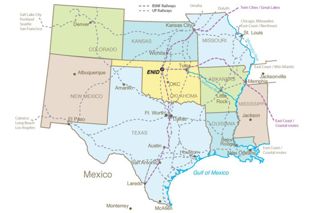
Two major rail carriers, Burlington Northern/Santa Fe and Union Pacific, provide effective service to and from Enid, linking the area to the west coast, the Pacific Rim, and to the NAFTA corridor to Mexico.
CTLC Enid offers direct access to BNSF track/service with reciprocal service from UP. In addition to rail service access CTLC can offer many track side development sites for material handling, transload facility or co location.
TP&L also has a transload and storage facility in Enid along the BNSF Mainline.


AIR.
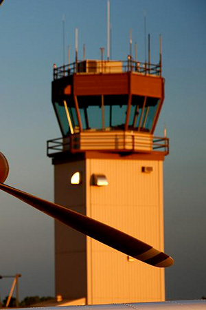
Enid is served by Enid Woodring Regional Airport, a Regional Business/General Aviation airport located approximately 5 miles east of downtown Enid. The airport is tower controlled with two runways; a 3,149 ft VFR cross runway and an instrument capable 8,000 ft long north-south concrete runway. Airport services include a restaurant, hangers for lease, aircraft maintenance facilities, a flight instruction school with aircraft rental and an industrial park designated as a general purpose foreign trade zone. Enid is also located within 125 miles of the Oklahoma City, Tulsa and Wichita commercial airports.

WATER.
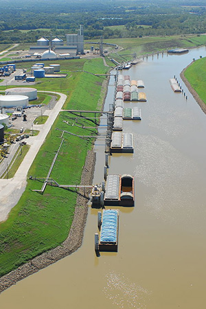
Enid, Oklahoma has serveral close ties for access to the McClellan-Kerr Arkansas River Navigation System including the Tulsa Port of Catoosa. Tulsa Port of Catoosa is one of the furthest inland black water ports in the US located at the head of navigation for the McClellan-Kerr Arkansas River Navigation System. The Tulsa Port of Catoosa offers year round, ice-free barge service with river flow levels controlled by the U.S. Army Corps of Engineers. With worldwide access capabilities, your products can travel easily and efficiently from Enid, Oklahoma to the rest of the globe. Enid is located only 130 miles west of the port and is connected via the Cimarron Turnpike. The Port of Catoosa is serviced by the SK&O and BNSF Railways.
